Author Archives: manonabeach

About manonabeach

On a beach…welcome to manonabeach.com, where I’ll regularly add video of my beach visits, so you can enjoy a flavour of the beach, even when you’re not there.

Selsey Bill

View map of beach Parking available Toilets available Medmerry Managed Realignment Scheme SSSI Dog friendly Beach cleaned regularly

Season: spring

A benign spell of weather made for a bright morning at Selsey Bill, with the inshore boats bringing whelks, crab and lobster ashore as I arrived.  I asked a retired fisherman, Norman James Woodland, what the beach means to him.  Before the interview, he told me traceable generations of his family had been fishing at Selsey Bill for 932 years, an unbroken chain that other families can also claim.  It was therefore a great pleasure to hear his recollections of time spent aboard and on land with his father.

The recollections of Norman James Woodland.

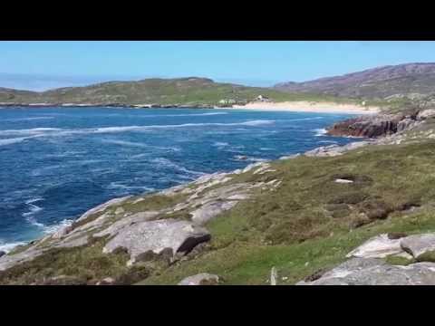
A morning scene at Selsey Bill in West Sussex.

Season: winter

The western shoreline at Selsey Bill has been protected and managed in two ways, with the West Sands Coastal Protection Scheme guarding the beach at the Holiday Park and the Medmerry Managed Realignment Scheme, developed by the Environment Agency.  That beach is on Manhood Peninsula, the most southerly tip of West Sussex.  This visit was to the eastern beach.  It’s a base for inshore fishermen and is well known for Selsey crab, as well as for hosting the Lifeboat Station.  The current station will soon be replaced by a new boat and launching system, as explained by coxswain Martin Rudwick, below.

Fisherman David’s relationship with the beach.

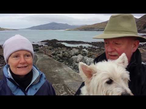
An interview with coxswain Martin Rudwick of the RNLI, the charity that saves lives at sea.

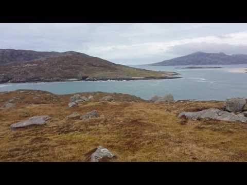
Looking back towards East beach in Selsey from the end of the Lifeboat House walkway.

Hemmick beach

View map of beach Parking available South West Coast Path SSSI National Trust Dog friendly

Season: spring

Bright sunshine greeted me on this spring visit to Hemmick.  As Giles explains below, the outstanding natural beauty of this part of Cornwall’s south coast owes much to the work of the National Trust.  Hemmick beach is a pleasure to visit at any time.  I recommend the path up through the woods to the Dodman Point, where you can see Iron Age and Napoleonic archaeology and history, as well as staggering views, either across to the Nare Head or back towards Vault beach.

Giles’ testimony to the conservation and husbandry of the National Trust at Hemmick beach and beyond on Cornwall’s south coast.

Season: winter

Outstanding visibility was the order of the day for this return to beautiful Hemmick beach. Visitors could see all the way to the tip of the Lizard peninsula and the sky was bright blue.  The walk down from the National Trust car park at Penare is steep, but it offers an outstanding view, drawing you down to the sandy beach.  It’s worth stopping on the steep return ascent to remind yourself of the unspoilt beauty and to frame a lasting image in your mind before you return.

What the beach means to Mark.

A bright blue day at Hemmick beach.

Season: spring

Clean surf crashed onto the beach at Hemmick for this spring visit.  The sky was blue, the weather warm and the sunshine bright in the morning sky.  As the tide turned inwards, odd weekending visitors started to settle for a restful day, collecting driftwood for their barbecues and stopping to gaze out over the waves, lost in their thoughts.

Lindsey and David reflect on beaches and coastlines.

By the water at Hemmick in the morning.

Season: autumn

One of Cornwall’s least spoilt beaches, nestled beneath the Dodman Point on the south coast of  Cornwall, Hemmick always seems to attract healthy surf, despite its southerly aspect.  Access is from Penare village at the top of a steep road or from a few parking spaces next to the beach.  If you’re feeling energetic, I recommend the headland walk up to the Dodman, where there’s archaeology and history aplenty to enjoy, as shown by the films below of the Napoleonic Watch House.

Up at the Dodman Point above the beach, here’s part 1 of a snapshot of life in Napoleonic times.

…and here’s part 2, as seen from the Watch House at Dodman Point.

Season: spring

This early morning visit showed the storm damage from the winter, with a significant cliff fall at the back of the beach.  Hemmick was stonier than on my previous visit, again due to the storms.  This morning was bright though, with blue sky and a silver sea as languid waves lapped the shore.  It heralded a warm, sunny day here on the south coast of Cornwall.

A variety of uses for the beach.

Huisinis beach

View map of beach Parking available Toilets available SSSI Dog friendly Good water quality for swimming

Season: summer

The spectacular approach to Huisinis beach whets the appetite for the pleasure to come.  You drive along a scenic, twisting fourteen miles long lane.  Spectacular Amhuinnsuidhe Castle guards the approach, with canons pointing seaward.  The beach itself is no disappointment, featuring white sand and backed by cropped grass.  If you stroll over the back of the hill, more visual splendours await, which on this occasion included a view to St Kilda on the horizon.

What the beach means to Dave.

A view towards Huisinis beach from the headland approach.

The scene behind the beach at Huisinis.

A German perspective on the beach from Isa.

Season: spring

If you want stunning beauty in an isolated setting, this could be the place for you.  Huisinis beach sits at the end of a long single track road in the southwest of North Harris.  It’s an area of outstanding natural beauty, with excellent sea trout and salmon fishing.  On the way to the beach, you pass Amhuinnsuidhe Castle and there are just a few houses by the beach itself.  Across the isthmus is the island of Scarp, the site of an experimental rocket postal service.

What the beach means to Katrina, Stuart (and Findlay).

A view from beside the beach at Huisinis.

A view from above both beaches at Huisinis.